Case Study
Wildlife conservation for the US military
The U.S. Department of Defense (DoD) manages over 26 million acres of land around the world, including hundreds of thousands of acres of wilderness. In order to manage these areas, the DoD natural resource managers monitor wildlife populations, protect natural resources, and ensure the continued health of the ecosystem.
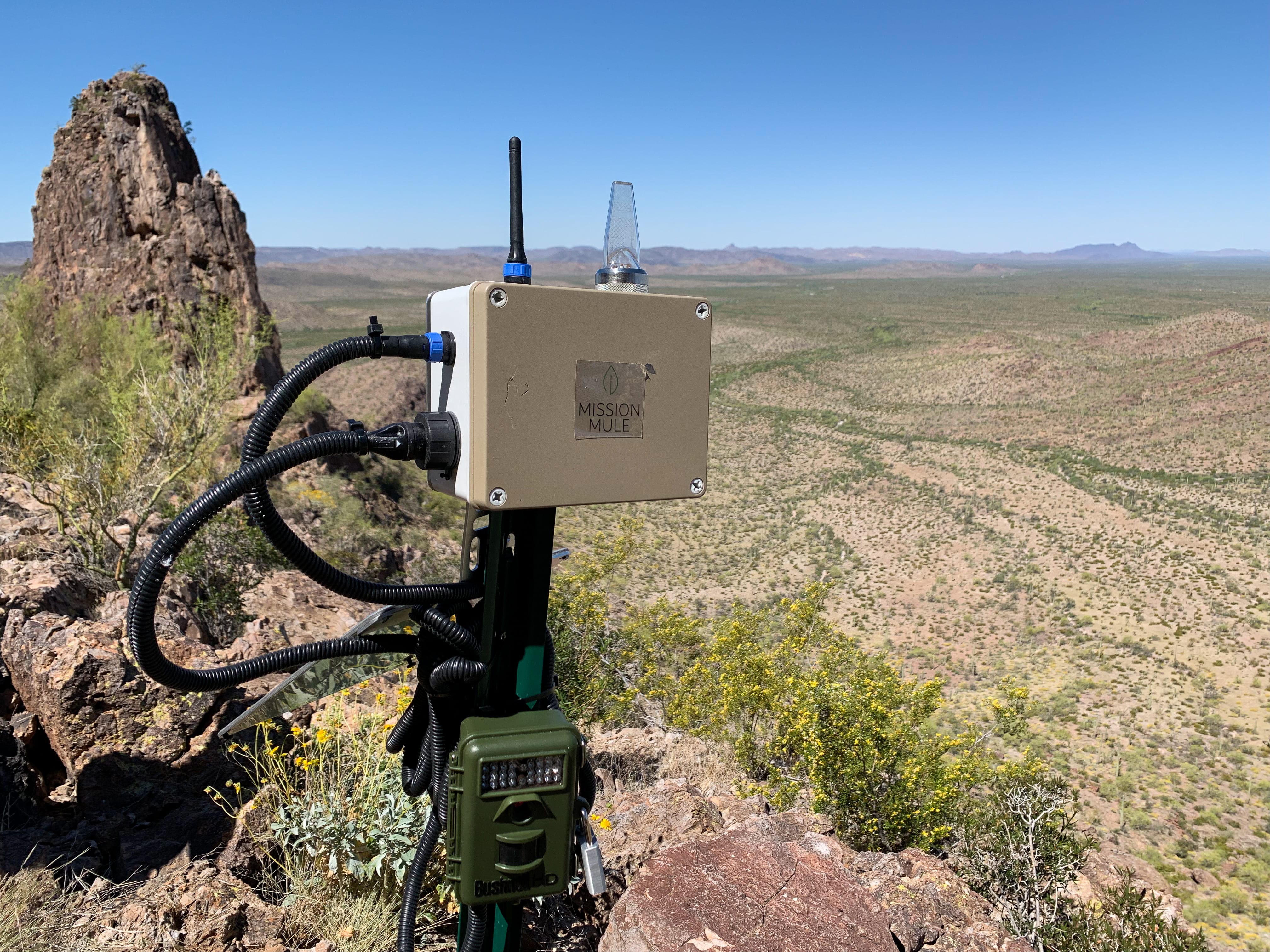
Motion sensor camera traps are a key tool for species conservation in many areas. Historically, natural resource managers would periodically hike or drive to camera sites to retrieve SD cards loaded with images. This task exposes field personnel to safety risks, is time-consuming, and often disturbs local wildlife.
Mission Mule partnered with the U.S. Army Corps of Engineers Construction Engineering Research Laboratory (USACE CERL) and the Naval Facilities Engineering and Expeditionary Warfare Center under the DoD's Environmental Security Technology Certification Program (ESTCP) to autonomous data retrieval hardware to better monitor wildlife populations, minimize disturbance of local wildlife, and reduce personnel safety risks.*
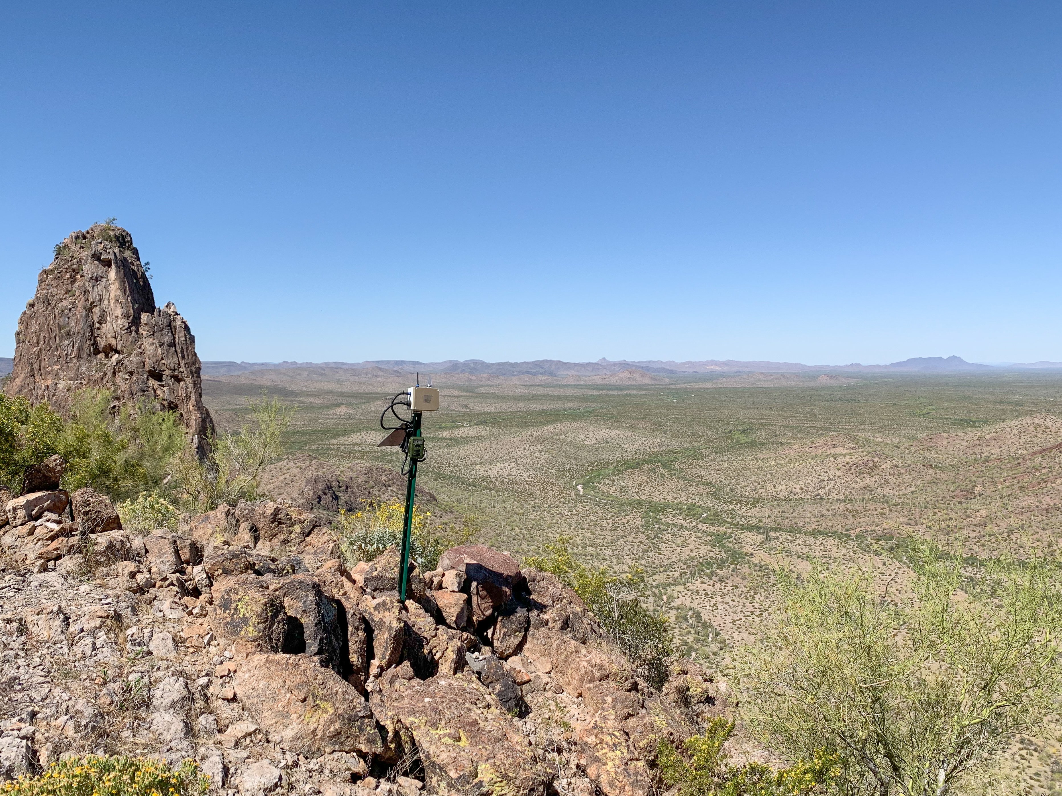
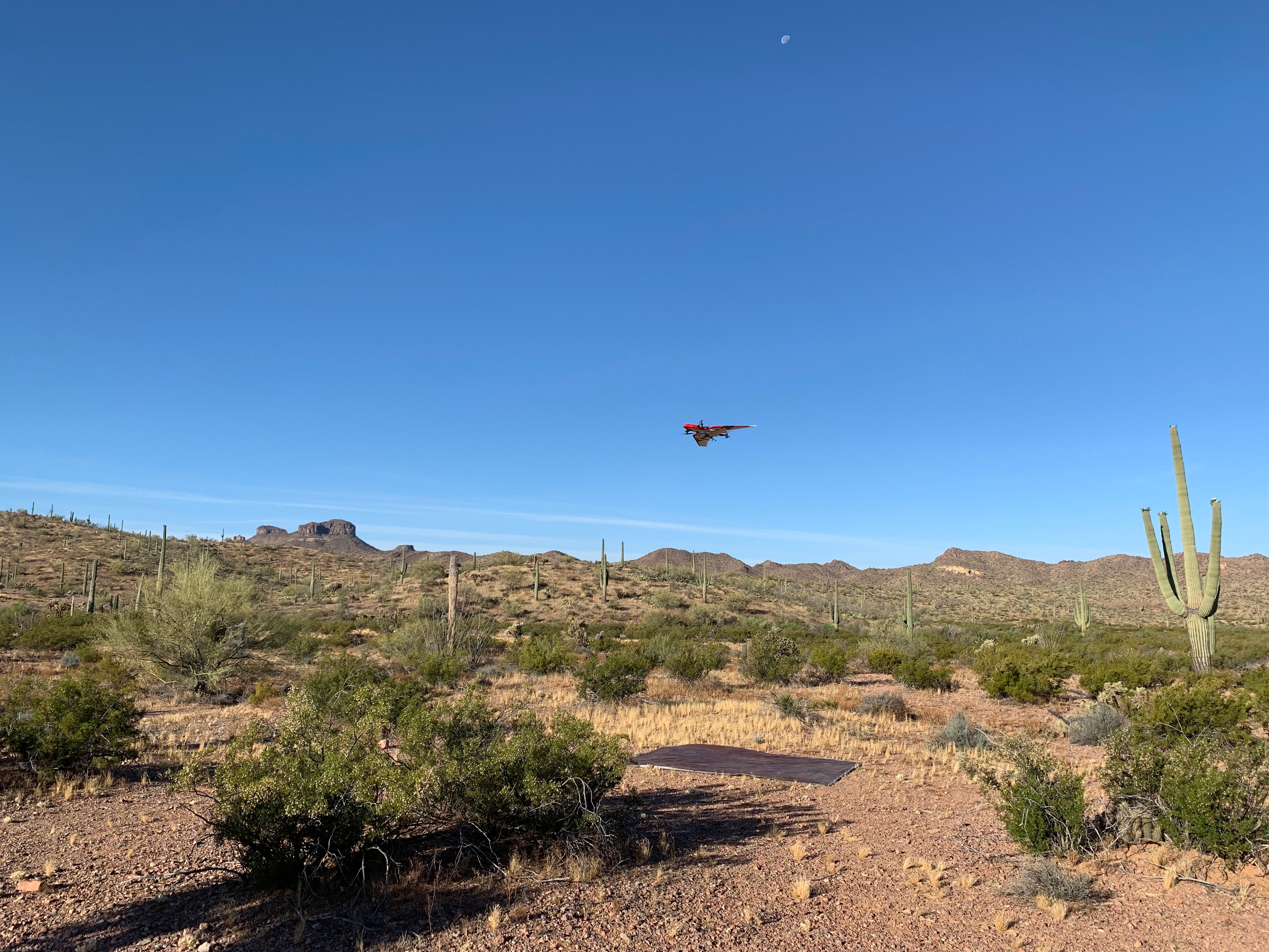
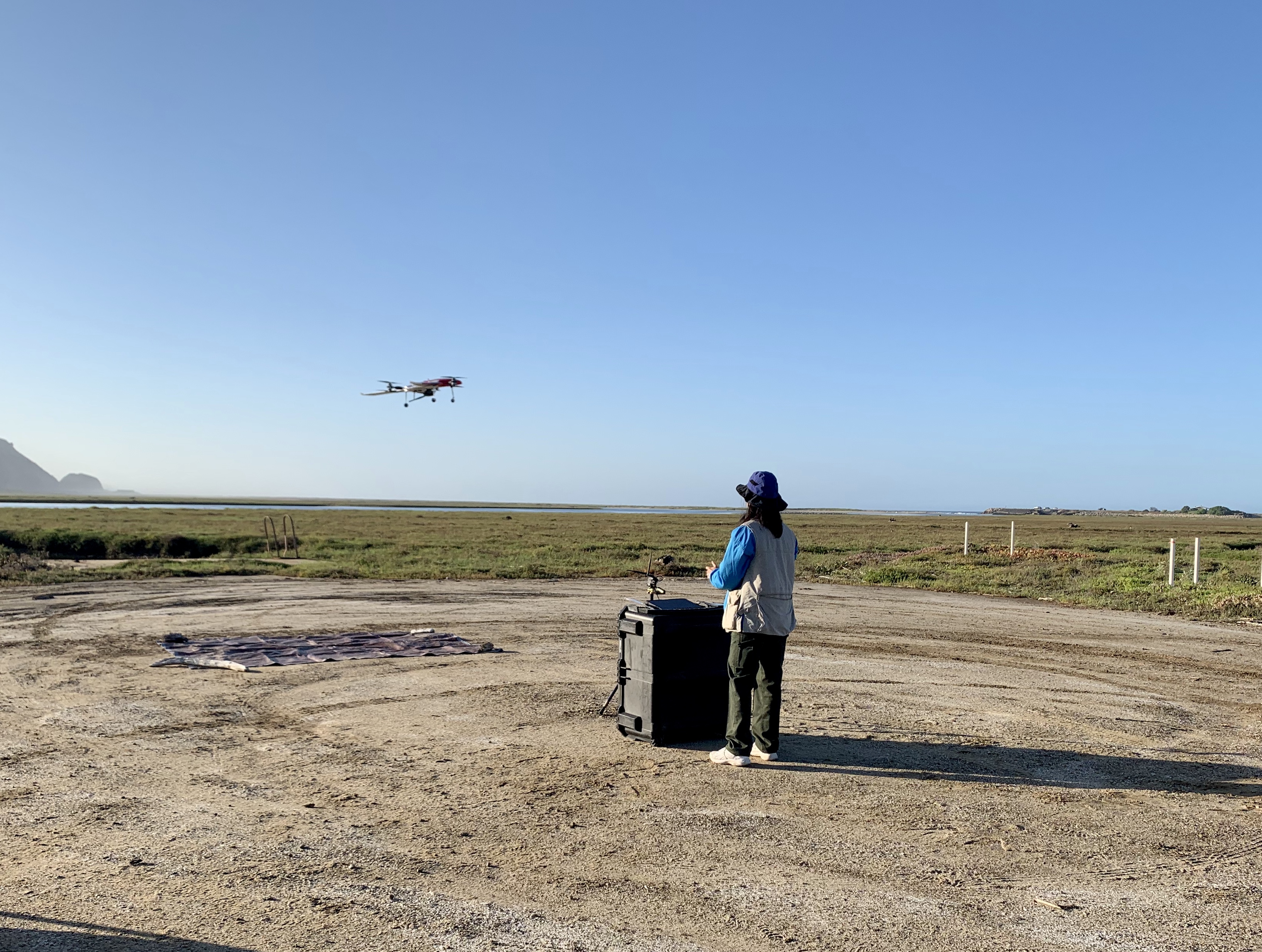
Mission Mule’s Data Mule UAS autonomously flies to a camera trap and circles overhead as the data is wirelessly downloaded. The UAS then visits nearby sites before returning home loaded with data to be offloaded by the flight crew. This technology allows researchers to regularly retrieve images from camera trap sites in hard-to-reach areas without exposing field personnel to excessive driving or hiking in hostile environments or disturbing wildlife with manual data retrieval.
Using the Data Mule UAS fully autonomous flight capability, field teams were able to fly extended missions and navigate complex terrain up to 12km (7.5mi) from the takeoff site. The Data Mule capability gives field teams the opportunity to regularly retrieve data from field sensors from across the range, significantly improving wildlife monitoring coverage and ensuring the continued health of the ecosystem.
Barry M Goldwater Range
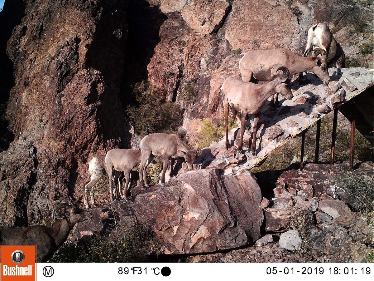
Barry M Goldwater Range East (BMGR-E) is administered by the U.S. Air Force and encompasses over one million acres of remote desert habitat in the American Southwest. The range is home to thousands of species of plants and animals including the Sonoran Pronghorn, an endangered species which is making important strides towards its recovery due to the ongoing efforts of range management teams at BMGR-E.
At BMGR-E, Mission Mule supported existing efforts to monitor wildlife populations with Data Mule-enabled motion sensor cameras located at artificial watering sites that local wildlife depends on to survive the harsh desert climate.
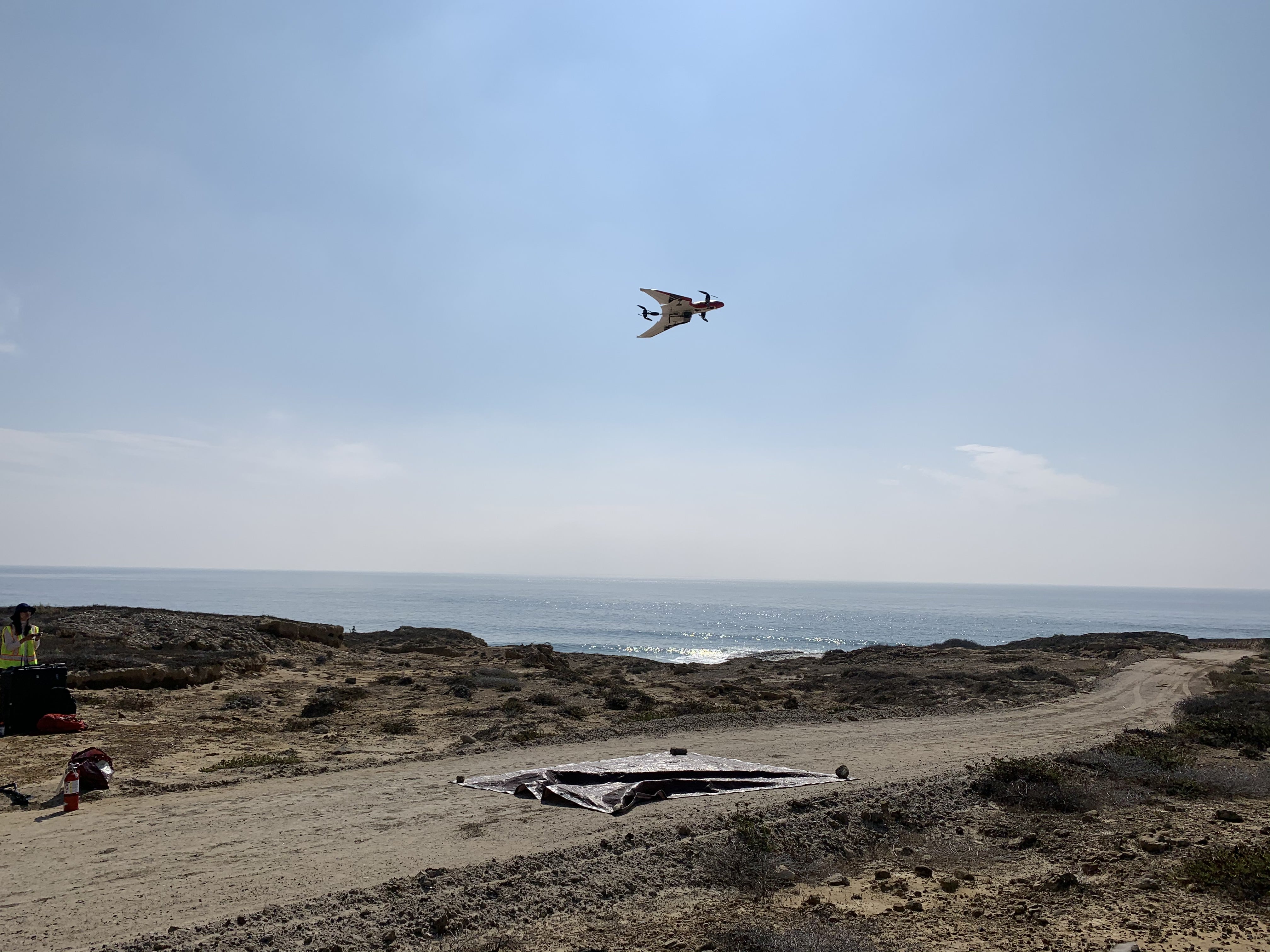
Point Mugu and San Nicolas Island
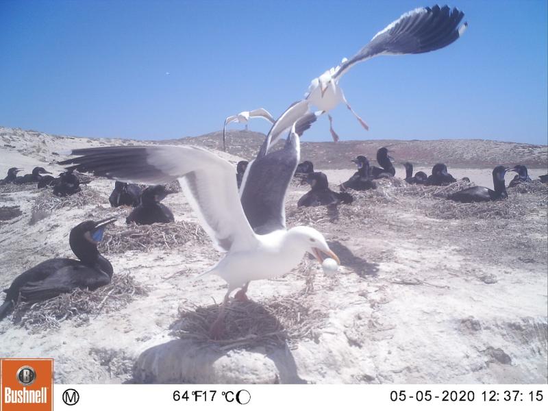
Mission Mule also installed its technology at two U.S. Navy facilities along Southern California's Pacific Coast, Point Mugu and San Nicolas Island. With their locations on the coast, these installations are known for their diverse wildlife including elephant seals, sea lions, and Brandt's cormorants, a species of concern.
Mission Mule's technology allowed field teams to autonomously retrieve images from camera traps located in the marshes at Point Mugu and from within coastal bird colonies on San Nicolas Island. The systems allowed field teams continuous access to areas that are difficult to regularly reach on foot for much of the year and without disturbing the ecosystem.
Wrapping Up
At these various sites, Mission Mule technology was used to accelerate ongoing conservation efforts of local species and ensure ongoing stewardship of military lands.
Moving forward, we are excited to partner with additional organizations to help field teams better manage their land and resources. Please reach out if you're interested.
* Collaboration between organizations within the U.S. Department of Defense (ESTCP, USACE CERL, NAVFAC EXWC) and Mission Mule does not constitute an endorsement of Mission Mule technology or products.